| A | B |
|---|
| Topography | The shape of the land. |
| Elevation | The height above sea level of a point on Earth's surface. |
| Relief | The difference in elevation between the heightest and lowest points of an area. |
Landform,  | A feature of topography. Ex: mountian, hill, valley |
Plain,  | A landform that is nearly flat or gently rolling hills. |
Mountain,  | A landform with high elevation and high relief. |
Mountain range,  | A group of mountians. |
| Plateaus | A landfrom with high elevation and low relief. |
| Landform region | A large area of land with similar topography. |
| Latitude | Distance measured in degrees north or south of the equator. |
| Longitude | Distance measured in degrees east or west of the prime meridian. |
Topographic map, 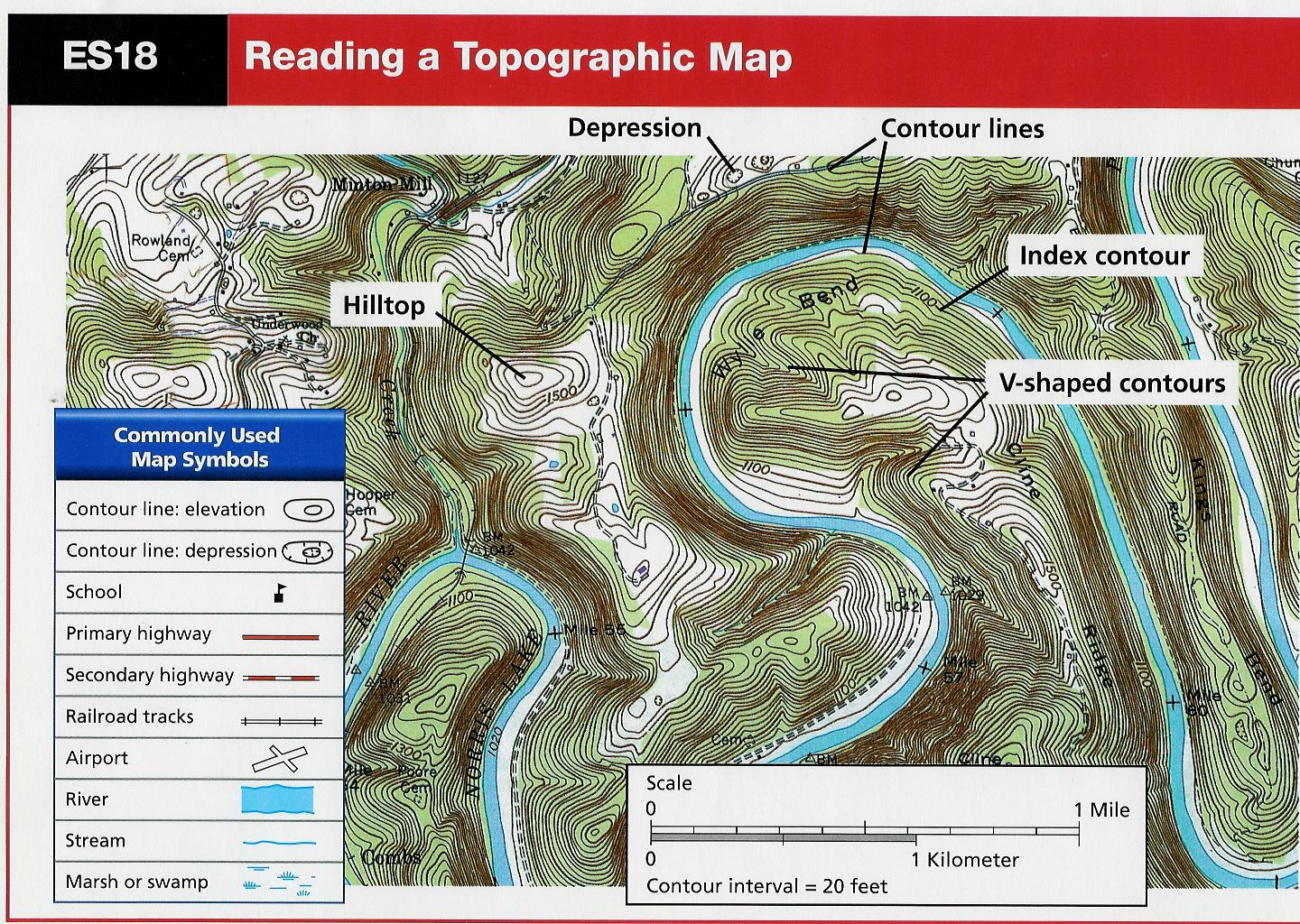 | A map that shows surface features of an area. |
| Contour lines, | A line on a topographic map that connects points of equal elevation. |
| Contour interval | The change in elevation between contour lines. |
| Index contour | A contour line whic indicates the elevation in round numbers. |