| A | B |
|---|
| Air Mass | A large amount of air that has a specific temperature and moisture level. Continental = dry Maritime = moist Arctic = very cold Polar = cold Tropical = warm, 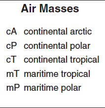 |
| Air Pressure | The force of air molecules pushing down on Earth. Measured in millibars or inches of mercury using a barometer. High air pressure = dry air and sunny. Low air pressure = cloudy skies and precipitation. Falling barometer = bad weather., 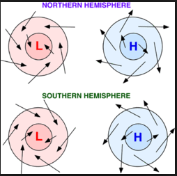 |
| Lake Effect Snow | Cold air mass moves over warmer lake water, water vapor from the lake evaporates, rises, cools and condenses to form snow. Occurs in the Greak Lakes region of New York., 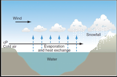 |
| Frontal Boundary (Front) | The transition between two air masses. Includes: Cold front, Warm front, Occluded front, Stationary front. The front symbols on a map show the direction the front is moving in., 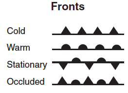 |
| Insolation | Incoming solar radiation (sunlight!) When the angle of insolation is direct (ex: at the equator), the temperature is warmer., 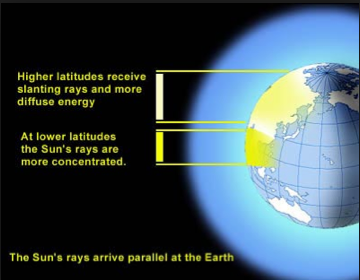 |
| Coriolis Effect | Moving objects (air) are deflected (bent) because of Earth's rotation. Northern hemisphere = deflected right. Southern hemisphere = deflected left., 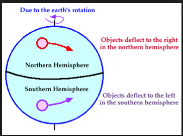 |
| El Nino / La Nina | Trade winds slow down in Central/Eastern Pacific Ocean, creating warmer water in the Eastern Pacific. This creates more rainfall and storms along western South America and droughts in Australia. La Nina is the opposite of El Nino: cooler temperatures in the Eastern Pacific waters., 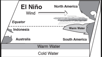 |
| Jetstream (planetary winds) | Fast-flowing, narrow air currents that form where two different air masses meet. Caused by Earth's rotation and uneven heating from the sun. Polar jetstream in higher latitudes and subtropical jetstream along mid-latitudes., 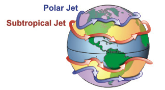 |
| Isotherm | A line on a weather map that has equal temperatures., 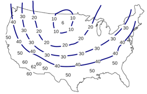 |
| Isobar | A line on a weather map that has equal pressure. Isobars close together = windy. High pressure = above 1013 mb, Low pressure = below 1013 mb., 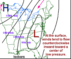 |
