| A | B |
|---|
After which war, and which peace settlement, would this map accurately illustrate?, 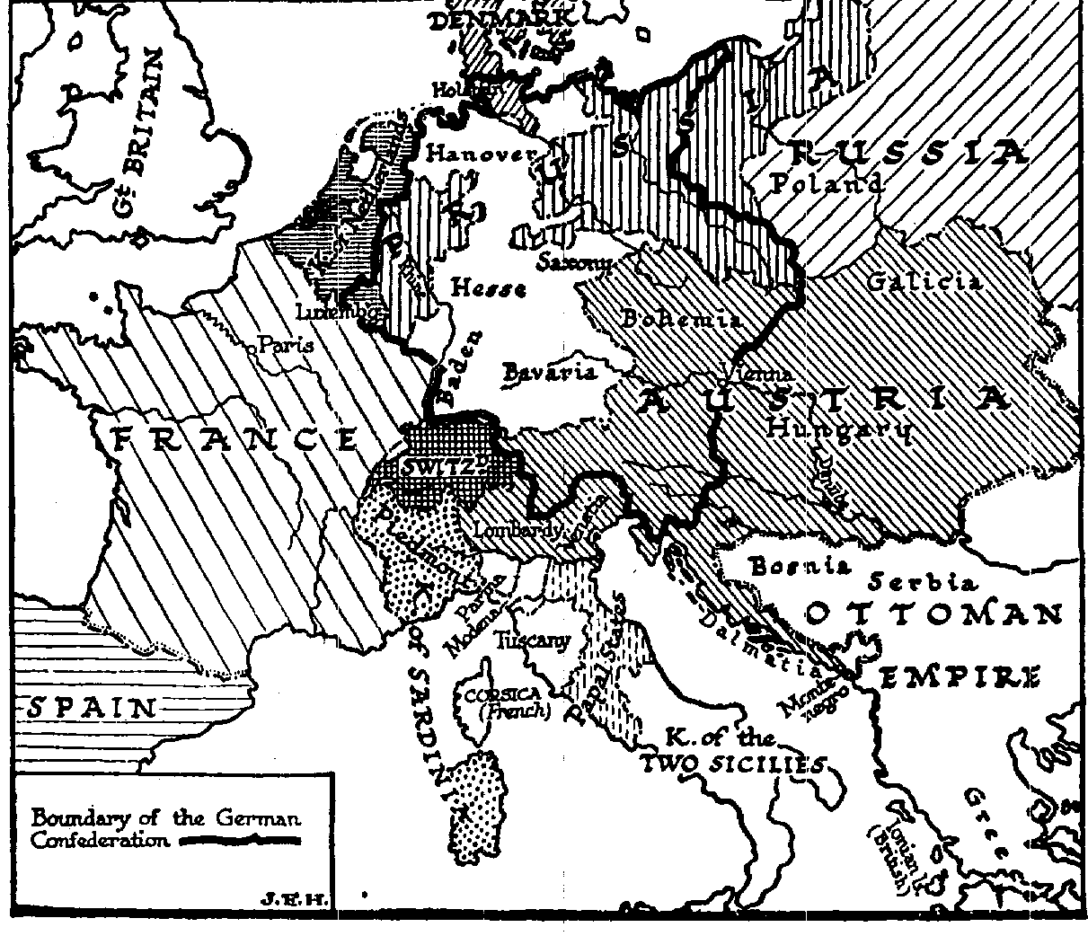 | Europe: 19th century; after the Napoleonic Wars and Congress of Vienna |
After which war, and which peace settlement, would this map accurately illustrate?, 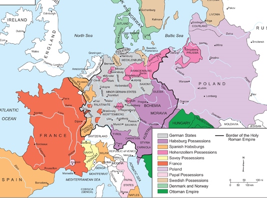 | Europe: 17th century, redrawn after the 30 Years War and Peace of Westphalia-1648 |
Which war does this map illustrate?, 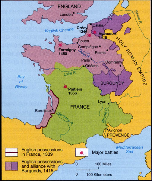 | The Hundred Years War |
For which historical era would this map be accurate?, 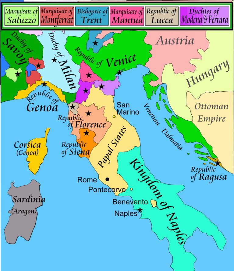 | Renaissance Era, (1494) |
For which war does this map accurately illusrate?, 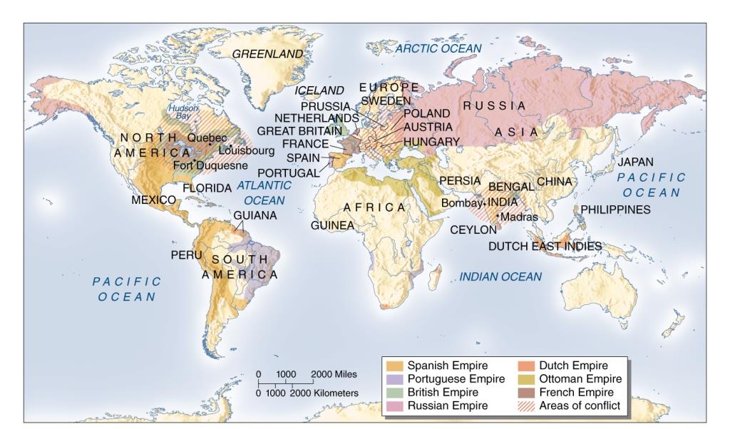 | The Seven Years War, from 1756-1763. |
For which war does this map accurately illustrate?, 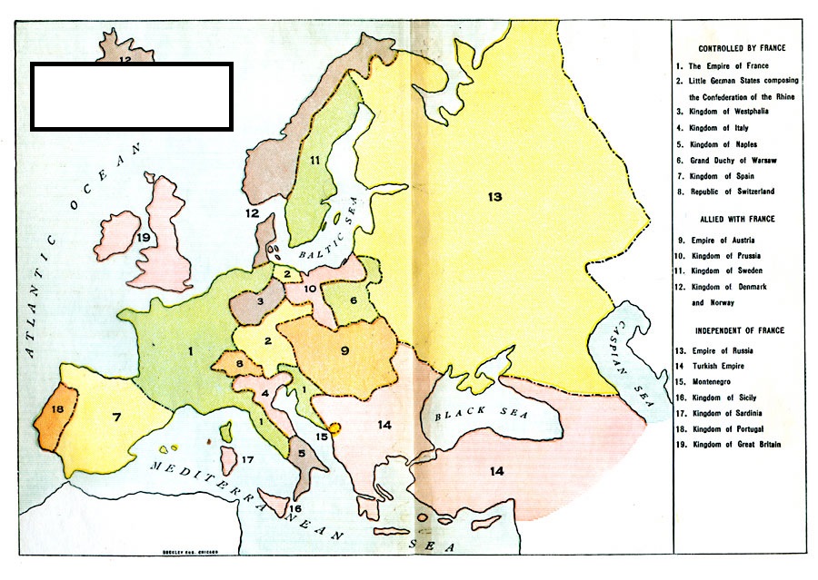 | Napoleonic Wars, 1810 |
This map would begin to be a reliable illustration in which century?, 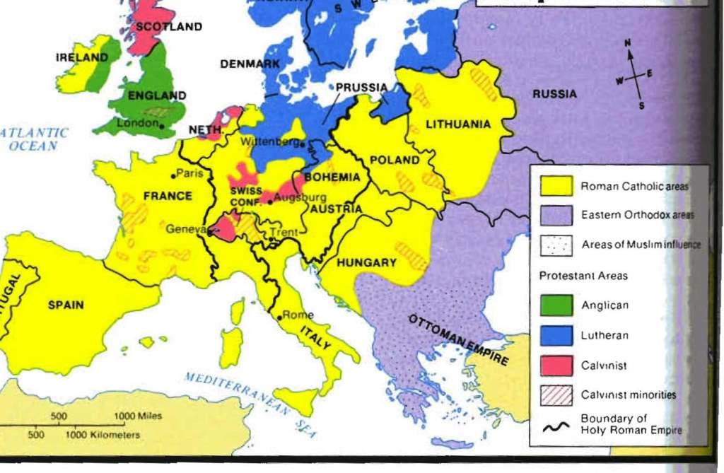 | This would be a reliable map starting in the 16th century (1500s). |
Which would be the last century in which this map would be reliable?, 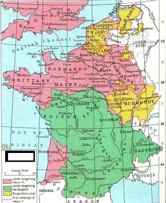 | This would be an accurate map for part of the 1400s, but not beyond that. |
In what century would this map be accurate? What specific event does it illustrate?, 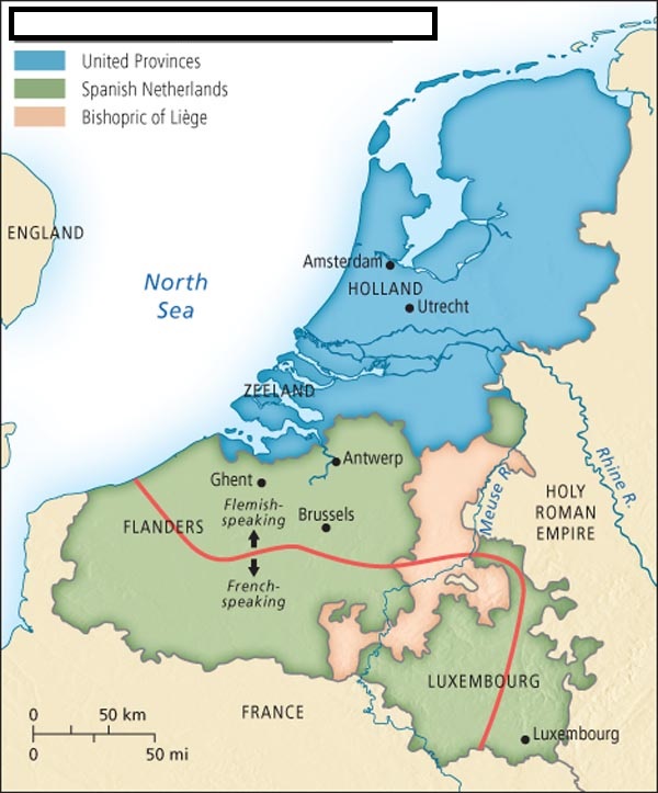 | 16th century: The Dutch Revolt against Spain in 1580. |
